Mapping the future of southern pine management in a changing world.
Virginia Tech M.S. student Brett Heim uses a LI-COR 6200 to measure soil respiration underneath a throughfall exclusion structure at the Virginia Tier III site.
Photo courtesy of John Seiler.
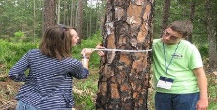
High school students participating in the University of Florida's Science Quest summer camp measure trees and calculate the amount of carbon stored in trees as part of the Project Learning Tree/PINEMAP Secondary Module activity "Counting the Carbon." Photo courtesy of Martha Monroe.
Leaf level gas exchange being measured on clonal loblolly pine at the cross carbon site installed by the U.S. Forest Service and Meadwestvaco.
Photo Courtesy of John Seiler.
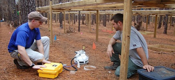
Throughfall exclusion structures under construction at PINEMAP Tier III site in Buckingham County, Virginia. Photo courtesy of Andy Laviner.
PINEMAP field researchers Geoffrey Lokuta and Joshua Cucinella use a LI-COR LI-8100A instrument to measure soil respiration at the PINEMAP Tier III site in Taylor County, FL. Photo courtesy of Jessica Ireland.
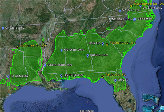
The green shaded area in this map depicts the native range of loblolly pine; blue tags show collaborating institutions and yellow circles show locations of manipulative field experiments to examine the interaction of soil nutrient and water availability.
Remote sensing image courtesy Google Earth; range map courtesy USDA Forest Service.
Graduate student mentor Elizabeth Wilson (left) and undergraduate fellow Madison Wigley (right) record pine needle fascicle lengths in a greenhouse experiment at Texas A&M University. Photo courtesy of Ayumi Hyodo.
As we progress through the final months of our project, it is important that we keep lines of communication open, stay as integrated as possible, and seek consensus on important scientific issues as they arrive. These are the primary functions of the All Team PINEMAP meetings, and why we are scheduling them monthly.
You will receive details and information for each meeting as the time approaches. We encourage everybody to attend these meetings, and to seek opportunities to more fully integrate your work with other PINEMAP participants, to ensure the best outcomes for our project.
PINEMAP Integration Platforms
An Integration Platform page has been set up on the Intranet site. This page contains PowerPoint files of each of the integration platform timelines updated at our annual meeting.
PINEMAP Data
The new user-friendly interface for TerraC is available by clicking on the data management tab on the left or by clicking here
PINEMAP data templates are finalized and ready for use! Click here to download the templates. All completed data forms should be e-mailed to Rosvel Bracho (rbracho@ufl.edu) for entry into the TerraC database. Please contact Rosvel if you have questions.