Mapping the future of southern pine management in a changing world.
-
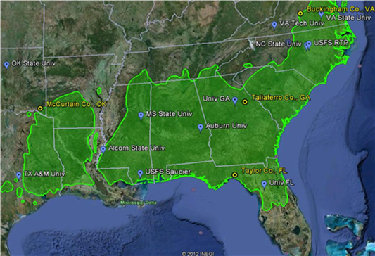
The green shaded area in this map depicts the native range of loblolly pine; blue tags show collaborating institutions and yellow circles show locations of manipulative field experiments to examine the interaction of soil nutrient and water availability. Remote sensing image courtesy Google Earth; range map courtesy USDA Forest Service.

-

Loblolly pine foliage and cone. Photo courtesy of John Seiler.
-
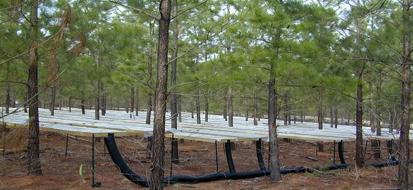
Throughfall exclusion structures at Tier III site in Buckingham County, Virginia. Photo courtesy of Andy Laviner.
-

Tier III throughfall exclusion and fertilization site in Taylor County, Florida. Photo courtesy of Jessica Ireland.
-

Sap flow monitors and throughfall exclusion structures at the Tier III site in Taylor County, Florida. Photo courtesy of Jessica Ireland
-
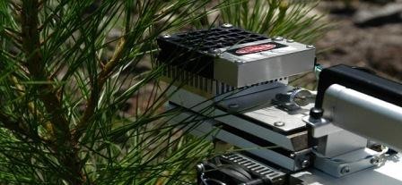
Leaf level gas exchange being measured with a Li-Cor 6400 portable photosynthesis sytem. Photo courtesy of John Seiler.
-
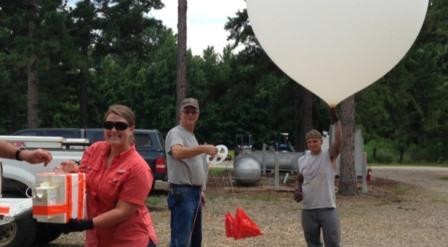
Brittany Baggett (left), a 2013 undergraduate fellow from the University of West Florida, helps launch a weather balloon at the Oklahoma State University research station in Idabel, OK. Photo courtesy of Casey Meeks.


PINEMAP Collaborators
Universities
University of Florida
|
Alcorn State University
|
University of Georgia
|
Auburn University
|
Mississippi State University
|
North Carolina A & T University
|
North Carolina State University
|
Oklahoma State University
|
Texas A & M University
|
Virginia Polytechnic Institute and State University
|
Virginia State University
University-Corporate-Governmental Research Cooperatives
Cooperative Forest Genetics Research Program |
Cooperative Tree Improvement Program |
Forest Biology Research Cooperative |
Forest Modeling Research Cooperative |
Forest Productivity Cooperative |
Plantation Management Research Cooperative |
Southern Forest Resource Assessment Consortium |
Western Gulf Forest Tree Improvement Program
Other
U.S. Forest Service | Southern Regional Extension Forestry | Southeast Climate Consortium | Additional Supporters


The Pine Integrated Network: Education, Mitigation, and Adaptation project (PINEMAP) is a Coordinated Agricultural Project funded by the USDA National Institute of Food and Agriculture, Award #2011-68002-30185.
- Log in
- Contact Us
- Subscribe
- May 08, 2026
-