


PINEMAP
Pine Integrated Network: Education, Mitigation and Adaptation Project (PINEMAP) Mapping the future of southern pine management in a changing world
PINEMAP is one of three Coordinated Agriculture Projects (CAP) recently awarded by the USDA National Institute of Food and Agriculture (NIFA). The purpose of these CAPs is to encourage agriculture and forestry producers to increase carbon sequestration and adapt practices to reduce the impact of climate variation. PINEMAP, a 5-year, $20 million project, focuses on planted pine forests in the Atlantic and Gulf coastal states from Virginia to Texas, plus Arkansas and Oklahoma, that are managed by industrial and non-industrial private landowners.
Research will focus on loblolly pine (Pinus taeda), which accounts for about 80 percent of planted forests in the region. The project’s overarching goal is to create, synthesize, and disseminate the knowledge necessary to enable southern pine landowners to: better manage forests to increase their ability to remove carbon dioxide from the atmosphere; more efficiently use nitrogen and other fertilizer inputs; and adapt forest management approaches and the planting of improved tree varieties to decrease risks from climate variability.
These outcomes will be achieved through integrated research and outreach programs for forest landowners and managers, and through formal educational programs for students. Important features of these programs include:
1. develop breeding, genetic deployment, and innovative management systems to increase carbon sequestration and adapt forest management practices;
2. investigate interactive effects of policy, biology, and climate on forest management;
3. develop and implement extension programming to transfer new management and genetic technologies to private industrial and non-industrial landowners; and
4. create educational resources and training programs to educate middle and high school students, teachers, and undergraduate and graduate students about the relevance of forests, forest management, and climate impacts.
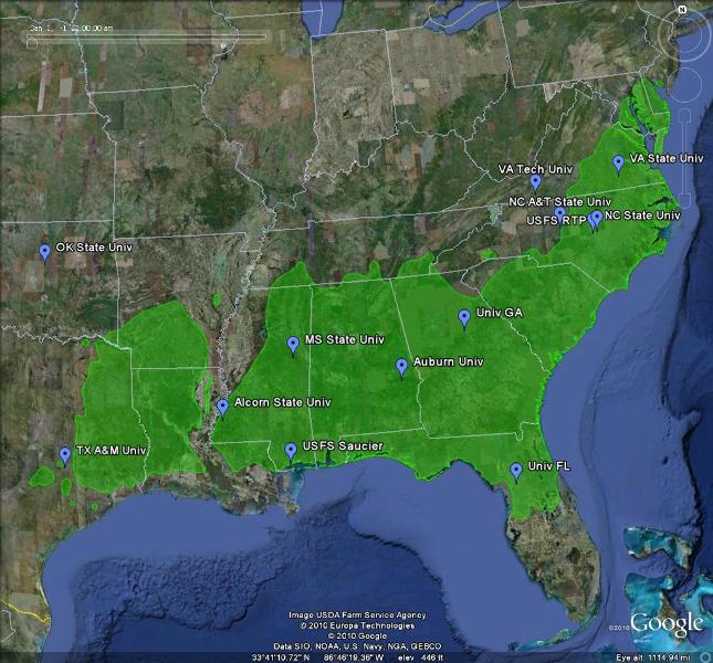
PINEMAP is coordinated and managed by the University of Florida; project collaborators include: 8 regional university-industrial-governmental forestry research cooperatives, 10 southeastern land grant universities, the USDA Forest Service, and state climate offices and the multi-state Southeast Climate Consortium.
For additional information, please contact Dr. Timothy A. Martin (tamartin@ufl.edu) or Jessica Ireland (jjtireland@ufl.edu).
This map depicts native range of loblolly pine in green; project collaborators are noted in blue.
Pine Integrated Network: Education, Mitigation and Adaptation Project (PINEMAP)
Mapping the future of southern pine management in a changing world